How is a flood made?
I built a visual explainer to find out. It starts weeks before it rains.
This summer the seas around Europe have been warmer than usual. The western Mediterranean had its warmest September in 87 years of records: 26.0 °C, against a normal of 23.6.
But the warm sea alone does not create a flood, it is a precondition. You also need a pool of cold air moving in high up, which is why these floods come in autumn, and wind to push the wet air onto the coast.
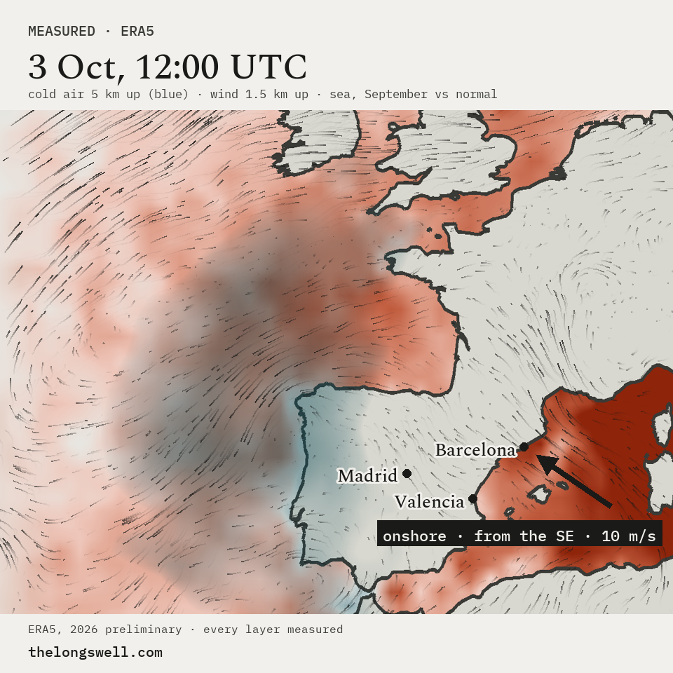
This already happened two weeks ago. Barcelona had its wettest day since its complete record began in 1978: 159 litres of water on every square metre at the Fabra observatory. That is a full bathtub of water for one square metre! (I had to double check.)
To me this shows that everything in nature is one system: the heat and the floods are the same system showing different results.
For this weekend the European weather centre (ECMWF) has a similarly worrying forecast for Spain and other parts of Europe, so I added that to the explainer too.
Barcelona. Daily rainfall: AEMET, station 0200E Barcelona Fabra, complete record from 1978. 159.1 mm on 3 October 2026, the wettest day in that record. Other Barcelona gauges read differently that day; this is one station.
Mediterranean. Sea surface temperature: ERA5 monthly means, western Mediterranean (Alboran, Balearic, Gulf of Lion), September 2026 26.0 °C against a 1991-2020 normal of 23.6 °C, the warmest of 87 Septembers since 1940.
Forecast. ECMWF IFS, quoted, not ours. Read from the Floods channel payload behind thelongswell.com/floods on 16 October 2026.
Map. ERA5 reanalysis, 3 October 2026 12:00 UTC: temperature about 5 km up (500 hPa) against normal, wind about 1.5 km up (850 hPa), and sea surface temperature for September 2026 against 1991-2020. 2026 data are preliminary.
We find climate signals in the data, and send you the ones that matter.
Confirmation email required. No spam, and every note stays free and public whether you subscribe or not.